Camping on the 36-mile Enoree Passage
Sumter National Forest is home to over 170,000 acres of rolling hills and quiet valleys. It is also home to the Enoree Ranger District near Whitmire and fishing, horseback riding, mountain biking, …
This item is available in full to subscribers.
Subscribe to continue reading. Already a subscriber? Sign in
Get 50% of all subscriptions for a limited time. Subscribe today.
Please log in to continue |
Camping on the 36-mile Enoree Passage


Sumter National Forest is home to over 170,000 acres of rolling hills and quiet valleys. It is also home to the Enoree Ranger District near Whitmire and fishing, horseback riding, mountain biking, hiking and camping. The 36-mile Enoree Passage of the Palmetto Trail is a perfect way to explore the forest’s lakes, rivers and valleys.
The trail is in 3 manageable sections. Last November, my grandpa Chuck McCurry and I hiked the 11-mile section 3 and in March, David Gabrielli and I hiked the 16-mile Section 1. Now Chuck and I were itching to get back out into the forest for another camping trip. We aimed to complete the 36-mile trail by hiking 9-mile Section 2.
On a weekend in May, we collected our gear and food and drove to Sumter National Forest. First, we dropped off Chuck’s car at Brickhouse Campground, then we drove in my car 15 minutes further to our starting point off the gravel Ridge Road.
Down the trail
We slung on our packs and headed down a closed off forest road to Duncan Creek. The floodplain was covered with water.
A long, wide boardwalk crossed the floodplain.
A fiberglass bridge crossed the creek muddy from recent rain.
Over the next 2 1/2 miles, the trail meandered through valleys and up ridges towards highway 72. The trail brought solitude. It was just us and the valley.
About a half mile from the road, the woods faded into a recently logged area. Young pine trees and grass rose about 6 feet with a narrow path for us to hike.
No canopy shaded us from the blazing sun.
Shortly, the trail crossed Highway 72 and we were back into the woods.
The trail meandered through a mostly dense pine forest, parallel to Stomp Springs Road about a mile. Thankfully the road had almost no traffic.
We hiked another half mile before turning onto a gravel forest road. At the end of that road, we were back into the woods and minutes from our campsite.
We reached the twin beaver ponds and another long boardwalk. They were more of a clearcut swamp but beautiful.
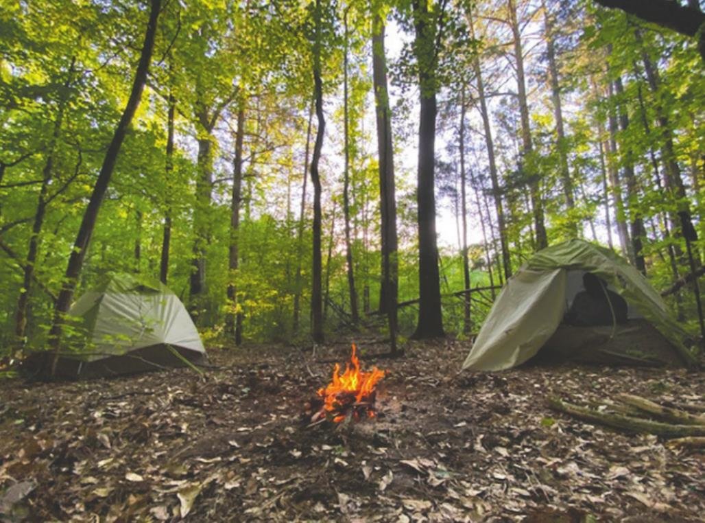
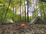
Stealth camping
The trail climbed a couple hundred feet to a spot I picked out the week prior.
We were stealth camping on a flat spot just above the creek that feeds one of the ponds. If you ever plan on stealth camping, or camping at an undesignated spot, leave it as if you were never there.
Before we could set up our tents and and take a quick nap, we had to clear sticks and pine cones. For a change, we made it long before dark so we had time to enjoy our camp.
A fallen cedar made the perfect fuel for a fire after dark. Cedar burns well, smells great and doesn’t give off too much smoke like other softwoods.
As the sun started down, we ate Ramen noodles and other snacks. By 9 pm, we were in our sleeping bags and asleep.
The next morning we were up by 8. We ate a small breakfast, took down our tents and crammed everything back into our packs. We checked to make sure we left no trace by picking up our trash and burying our ashes.
We had 4 miles to hike before the 1st 90-degree afternoon of the year so we weren’t wasting any time. It was cool starting off but we quickly warmed up.
The trail was beautiful.
We enjoyed walking through quiet and peaceful valleys by early morning sunlight. Little creeks cut through each valley and rocks jutted out of the creekbed to make little waterfalls.
With a mile left, I could see on my elevation map we had a big climb ahead.
By now it was 85 degrees and sunny. We began the climb in a pine forest which soon cleared to an open logging area.
Pine trees every 50 yards provided rest stops but what would have usually been a moderate climb was made harder by heat and the sun.
Thankfully, after the climb we crossed the road and were back at Brickhouse Campground.
We had a great time on another great section of the Palmetto Trail.
If you are looking for a fun hike, I would definitely recommend visiting Brickhouse Campground or the beaver ponds.
Directions to Brickhouse Recreation Area from Lexington
Take I-26 West to Exit 60, SC-66 Whitmire Hwy, turn right towards Whitmire.
For 3.6 Miles, follow SC-66 to Brickhouse Campground (right turn).
Directions to Twin Beaver Ponds 1hr, 5 min from Lexington
Take I-26 West to Exit 60, SC-66 Whitmire Hwy, turn right towards Whitmire.
Follow SC-66 3.6 miles to Stomp Springs Road just past Brickhouse entrance.
Left onto Stomp Springs Road, follow for 3.7 miles.
Right turn on Rail lane (gravel road).
Follow for 0.5 mile to turnaround.
Park and hike 0.2 miles to boardwalk.
Cole Stilwell is a junior at Gray Collegiate Academy and electronics and social media intern at Lexington County Chronicle/ His World Outdoors appears regularly in the Chronicle and Lake Murray Fish Wrapper.


Comments
No comments on this item Please log in to comment by clicking here