
UPDATED: Snow expected this weekend in Lexington County
4 to 8 inches of snow possible by Saturday night; warming center open Saturday through Monday
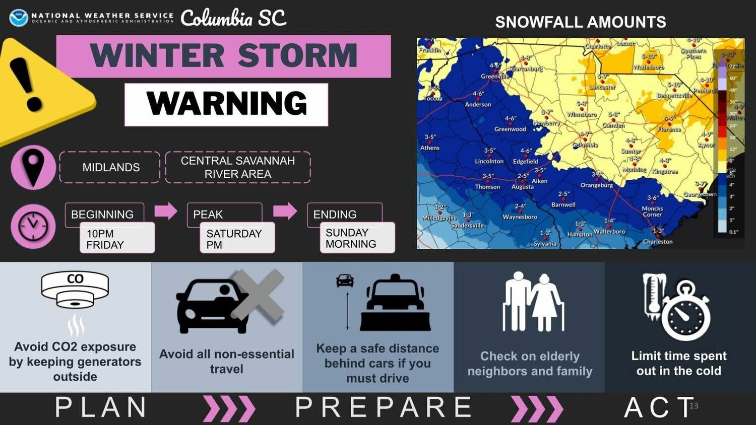
The National Weather Service station in Columbia says, as of Friday afternoon, there is a nearly 90% chance of snow on Saturday in Lexington County.
A winter storm warning is in effect starting 10 p.m. on Friday through 10 a.m. Sunday, along with an extreme cold watch in effect from Saturday night through Sunday morning.
Snow is possible tonight after midnight, but little accumulation is expected during that timeframe as of now. Overnight lows are expected to be in the 20s.
Saturday is when the most snow is expected. With accumulation predicted between three and five inches during the day, temperatures will likely be in the upper 20s, then may fall into the teens on Saturday night. By the time Saturday night comes around, there may be as much as eight inches of snow on the ground.
Sunny conditions are predicted for Sunday, with temperatures in the 30s. Sunday night temperatures will likely be in the teens, while Monday is predicted to see warmer temperatures in the 40s.
Keep track of impacts to Lexington County roads through this link, provided by the county: https://lexco-gis.maps.arcgis.com/apps/dashboards/2e561c02866c41489215158c41015db3.
As of this publication, there are no road closures, according to the link.
A warming center will be open at Radius Church in the White Knoll area, located at 5181 Platt Springs Rd., which is roughly a 7-minute drive from White Knoll High School. That warming center will be open from 7 p.m. to 7 a.m., Saturday through Monday.


Comments
No comments on this item Please log in to comment by clicking here