Going through the Carolinas on the Broad River
Where does the Broad River come from?
You know it ends in Columbia where it meets the Saluda to form the Congaree.
But where does it flow above Columbia?
I intended to find out.
…
This item is available in full to subscribers.
Subscribe to continue reading. Already a subscriber? Sign in
Get 50% of all subscriptions for a limited time. Subscribe today.
Please log in to continue |
Going through the Carolinas on the Broad River


Where does the Broad River come from?
You know it ends in Columbia where it meets the Saluda to form the Congaree.
But where does it flow above Columbia?
I intended to find out.
With a couple of friends, we followed the river from Columbia to its North Carolina headwaters.
Along the way, we discovered new places and learned the river’s rich history.
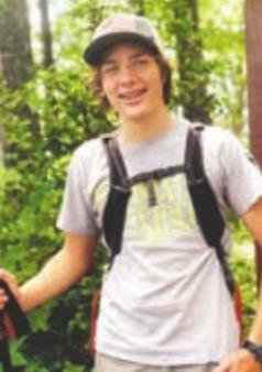
At 7 am on the 1st freezing morning of November, my friends, Chloe Terry and Kendall Prevatte started this new adventure into the unknown with me.
We drove toward Carlisle, a small town inside Sumter National Forest and near the river. Highway 176, took us most of the way.
On entering the 170,000 acre forest, we got side-tracked. We saw signs for Mollys Rock Picnic Area and decided to check it out.
There we found a nice picnic shelter overlooking a small field with a pond. A wide deck jutted out over the lake. It was the perfect spot to bring a family for a picnic.
At the dam, we found a hiking trail into the woods. It was frigid but we wanted to see what the trail had to offer.
THE SHORT HALF-MILE trail took us through a pine forest downstream from the pond to a pretty spot with a bench overlooking the floodplain. The trail crossed the creek and headed back to the other side of the dam, completing the loop.
Back on the road, we drove through Whitmire and Carlisle before finding the Broad River. We were about 50 miles upstream from Columbia.
We skipped over other notable points along the river such as Harbison State Forest, the Palmetto Trail crossing at Peak, and Parr Reservoir.
We crossed the river into Chester County on SC-215. We were on the way to Neals Shoals Dam, an old hydroelectric dam.
We turned onto a county road and onto a forest service road. We followed a steep gravel road back into the Broad River Valley to a turnaround.
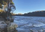
We could hear the roar of the river falling over the huge spillway from the car.
The dam was a massive, 1,100 feet wide and at least 30 feet tall. The spillway dropped water into a rocky shoals before rejoining the river.
An old brick powerhouse on the other side of the river gave away the dam’s age. Built-in 1905 by the Union Power Company, it’s one of South Carolina’s oldest.
Further up the road, the Woods Ferry Recreation Area had a 28-site campground, picnic shelters and 2 decks looking over the river. The river side was caked in thick, slippery mud from recent floods. This was the 1st day the river was back to a normal level.
A 21-MILE NETWORK of trails known as the Woods Ferry Horse Trails ends in the campground, however, it’s not the main trailhead. Since we weren’t camping, we moved on. For the next 5 miles, we drove down a gravel forest road to reach the main highway. It was surprisingly hilly considering we were so far from the mountains. We passed the new trailhead for the Woods Ferry Horse Trails, It has a huge gravel parking lot with a kiosk and maps. I hope to return for a backpacking trip later this winter.
We crossed the river again and into the small town of Lockhart. From the top of the hill, we could see rows of houses in the field down to the Lockhart Canal. A levy keeps the canal from flooding the town.
Upstream, the Lockhart Dam splits the river into the Canal and the Shoals with a long island in the middle.
Lockhart was home to one of several locks along the Broad River built in the early 1800s to connect the upstate to Charleston. However, shortly after its completion, the railroads rendered them obsolete.
The lock was converted to power the Lockhart Mill and more recently, a hydroelectric plant.
On the island where the mill used to be, the town has opened a half-mile paved trail with fitness stations.
We passed through the small town of Cherokee Falls where the houses sit on the side of what should be inhabitable steep hills overlooking the river. Another dam ran across the river but we couldn’t get to it.
NEXT, WE WENT to Cherokee Ford Recreation Area on the other side of the river in Gaffney where a new 1.3-mile loop trail opened earlier this year. We found a playground and played like kids for 30 minutes and I got my daily run out of the way. The wide, crushed gravel trail started with the river in sight before turning up into a valley. I climbed up to a ridge and crossed the road, I ran back by the playground and baseball fields before zig-zagging into a secluded valley and back to the river.
After my run, we filled up with Chick-fil-A before making it to one last spot. We followed the river into its headwaters to hike the Broad River walk. The river was noticeably more narrow than where we started out.
The river flowed through a gorge, Hills rose above it. The river’s small rapids made soothing white noise as we walked upstream. About a half-mile in, we found a nice bench over the river to watch the sky darken and the sun set behind the hill.
With that perfect ending to a long day, we headed home.
If you have any ideas of where I should visit next, please email me at cole.lexchron@gmail.com.
Check back next month for my exciting hike on the Ridgeline Trail at Kings Mountain State Park.


Comments
No comments on this item Please log in to comment by clicking here